
exploration / 2026-10-20
Satellites reveal the human imprint on the water beneath our landscapes
NASA’s October 20 account of a September study connects hidden water-storage changes with irrigation, reservoirs and land use.
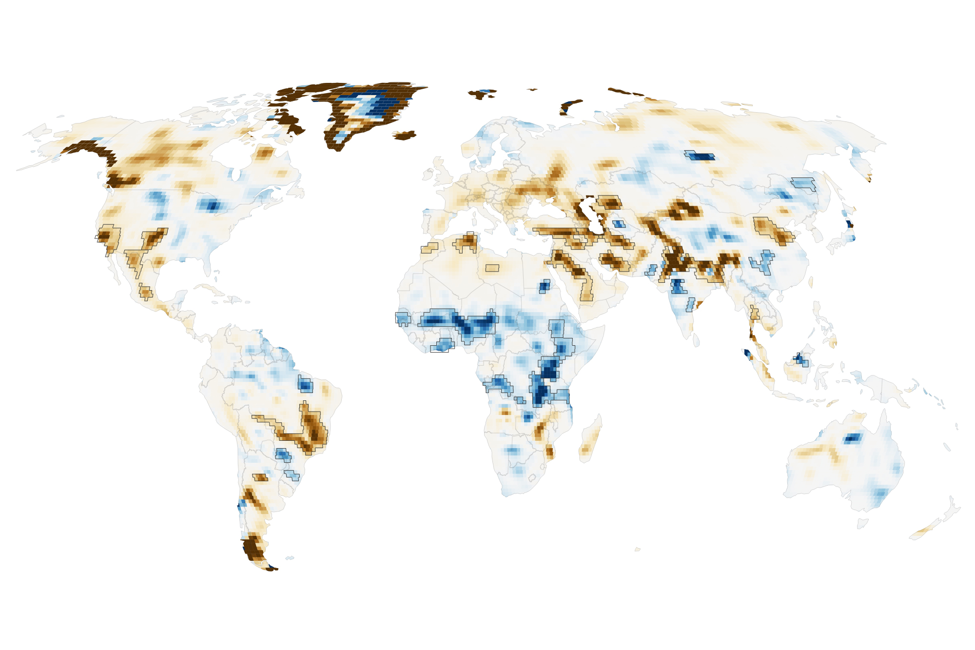
A field can look green while the water beneath it is declining. A reservoir can transform a valley while changing storage beyond the shoreline. An October 20 NASA account draws attention to these less visible parts of a landscape through a new analysis of satellite gravity measurements.
The research, published in PNAS on September 14, examines terrestrial water storage from April 2002 to November 2025. It uses data from GRACE and GRACE Follow-On, missions that detect small changes in Earth’s gravity as mass is redistributed. Water and ice are part of that changing mass.
Researchers identified 40 regions where strong water-storage trends were associated with human activities, including irrigation, reservoir filling and land-use change. Groundwater depletion linked to farming was particularly important in several regions. Other locations showed gains associated with different activities.
The method improves spatial detail by combining observations across many years. That brings smaller patterns into focus, but gives up temporal detail. It is a way to investigate long-term change, rather than a live reading of the water available at a particular village well today.
That distinction preserves the wonder of the map without asking it to answer questions beyond its design. A changing colour represents a measured trend and an analysis of possible drivers. Understanding any one place still benefits from local measurements, knowledge of water use and careful attention to uncertainty.
For explorers, the work invites a different way of seeing familiar terrain. A canal, a crop or a dam is part of a larger water system, connected to places that may be out of sight. Following those connections can make a landscape more understandable—and show why its future depends on choices as well as weather.
Publication note: This October 20 edition was published on October 21, 2026 to complete missed coverage. Featured image: NASA’s map of long-term water-storage trends, not an image of current drinking-water access.
Take action
Sources
- NASA Earth Observatory — October 20 account of the water-storage research ↗
- O’Neill, Rodell and Loomis — PNAS study, September 14, 2026 ↗
Original reporting synthesis by The Raines Foundation, based on the sources above.